by Rick Pruetz, FAICP
Anyone interested in planning sustainable communities can gain insight and inspiration from the first five cities to win the title of European Green Capital. For each of the past five years, the European Commission has named one city its Green Capital as a way of recognizing and promoting cities aiming to reduce their ecological footprint. To win this prize, cities submit applications and are judged by a panel of experts on accomplishments in 12 criteria: climate change mitigation and adaptation, local transport, green urban areas, nature and biodiversity, air quality, noise, waste management, water management, waste water treatment, eco innovations, energy, and integrated environmental management.
This article focuses on the diverse ways in which these five winners create networks of green space and nature. In addition to the inherent value of protecting habitat and ecosystems, success in these two criteria promote success in most if not all of the other criteria. For example, greenways and greenbelts benefit water management, reduce energy consumption by offering non-motorized transportation alternatives, and can be used to shape compact cities with efficient public transportation and other infrastructure. These five Green Capitals also illustrate the importance of using green areas and nature to help create inviting cities where people want to live.
NANTES, FRANCE
Nantes, France, and its surrounding conurbation, with a total population of 600,000, won the Green Capital award in 2013. Located on the banks of the Loire River, 35 miles upstream from the Atlantic Ocean, Nantes was historically a seaport and an industrial center. But de-industrialization took its toll, most alarmingly with the closing of its shipyards in 1987. Since then, Nantes has revitalized itself with government institutions, corporate offices and recognition as a sustainable community or, as Nantes prefers, a “green and blue city.” Perhaps the most striking symbols of this rebirth are the fanciful, animated artworks created in repurposed shipyard buildings, including a 40-foot high mechanical elephant that generates attention whenever it walks around town with 50 passengers on its back.
Nantes’s green roots predate the French Revolution, when this port city served as a nursery for botanical specimens brought by boat from around the world and ultimately bound for royal destinations in and around Paris. Some older gardens exist to this day, most famously the Jardin des Plantes, established in 1806 and now home to 11,000 species and varieties. In keeping with its playful and creative personality, when Nantes redevelops its brownfields into eco-neighborhoods, it sometimes celebrates its industrial as well as horticultural heritage. For example, the Foundries Garden retains the framework and furnaces of a factory where ship propellers were once forged as the setting for a new public garden with 200 trees and 100 plant varieties.
The “blue” in “green and blue city” refers to the 155 miles of waterways that flow through this city, including more than 100 miles that Nantes has restored or plans to restore. Along with the customary benefits of waterway enhancement, such as improved water quality, flood water management, and habitat preservation, Nantes also created a 150-mile long network of “waterside walks” giving pedestrians and cyclists access to nature as well as alternative travel options. Some of these waterside walks link the city center with the edges of the conurbation and beyond. The waterside walks on the banks of the Erdre River were once part of the 239-mile Nantes-Brest canal system, and bicyclists still use the canal tow paths to reach towns throughout Brittany. Another route heads east from Nantes along the Loire River, giving cyclists their choice of riding for an hour, a day, or several weeks on La Loire a Velo and Eurovelo 6, a 2,200-mile, 10-country bike network connecting France with Romania.
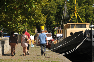
Figure 1
A waterside walk on the Erdre River in Nantes, France
In addition to gardens, parks, and blueways, the entire Loire River corridor within Nantes, including its shoreline, islands, and associated wetlands, is protected under Natura 2000, the network of preserves established to promote biodiversity throughout Europe. In the Loire corridor and three other Natura 2000 zones, Nantes reserves more than 17,000 acres, or almost 13 percent of its territory, for the protection of 174 plant species and 208 animal species listed as protected, rare, or threatened. Coupled with environmental restoration, Nantes has reduced pesticide use by 85 percent and uses bees as a natural monitoring system to track environmental health. To support its bee population, the city maintains apiaries in gardens, parks, and on buildings in the city center, including the rooftop of the Opera House.
In 2013 alone, Nantes hosted the conferences of 11 organizations working on sustainability issues, including the 2013 Ecocity World Summit, which gathered 2,000 attendees from around the world to learn from each other. In the process of sharing its experiences, Nantes is clearly building its international reputation while pursuing its economic development and eco-tourism strategies.
VITORIA-GASTEIZ, SPAIN
Vitoria-Gasteiz, Spain, the 2012 Green Capital, committed in its 1999 general plan to create a greenbelt surrounding this city of 240,000 people located 40 miles southeast of Bilbao in the Basque Country. Implementation of this ambitious goal required the ecological restoration of gravel pits, burned areas, and other disturbed land on the urban fringe, including the Zadorra River corridor, which needed a hydrological as well as environmental makeover. As its most remarkable achievement, Vitoria-Gasteiz transformed an agricultural area into the Salburua wetlands, now home to the threatened European mink, numerous bird species, and a herd of deer imported to control the marshland vegetation.

Figure 2
Vitoria-Gasteiz uses deer to control vegetation in the Salburua wetlands
To maximize public access to these natural areas, the city extended 56 miles of bike paths and walkways throughout the greenbelt, offering off-road hiking or pedaling around the entire city perimeter. These greenbelt paths also are connected to pedestrian routes within the city and an extensive bicycle infrastructure that allows cyclists to reach any part of the city in 15 minutes or less. Furthermore, the bike network links with regional trails like the Green Route to Arlaban, a rail trail allowing car-free escape to the agricultural countryside beyond the greenbelt.
Unlike the outskirts of many U.S. cities, the hinterlands of Vitoria-Gasteiz are largely free of sprawl. The urban area within the greenbelt comprises less than 15 percent of the total land area of the municipality but accommodates 98 percent of the total population. From 2001 to 2010, the city maintained that ratio, capturing 97 percent of the municipality’s total growth within the greenbelt by aggressively redeveloping underutilized properties at urban densities. In the two neighborhoods adjacent to 247-acre Salburua Park, the city introduced a policy known as re-densification calling for increases in the densities previously found in the general plan. Although re-densification proposals generate tension within neighborhoods, the city has found that residents ultimately learn that these actions improve local commercial activity, safety, public services, and urban amenities, such as the ability to stroll through an adjacent natural area like Salburua to see the ducks and deer.
The words “Green Capital” are now part of the Vitoria-Gasteiz logo, which appears at every gateway to the city. In addition to becoming a centerpiece of its strategies for tourism and overall economic development, the award helps build public support for the many green initiatives that Vitoria-Gasteiz has planned for the future.
COPENHAGEN, DENMARK
Copenhagen, Denmark, population 560,000, is consistently near the top of list of the most bike-friendly cities on earth. It has earned that reputation with more than 255 miles of bike lanes and bikeways. In addition to bike infrastructure, Copenhagen motivates cycling with promotional campaigns like “good cycle karma,” which distributes free chocolate to bicyclists. As a result, 35 percent of work and school trips in 2010 occurred by bike. Not content with that achievement, Copenhagen aims to become the “world’s best city for cyclists” with 50 percent of people cycling to work or school by 2015. This target is linked to Copenhagen’s even more ambitious goal of achieving carbon neutrality by 2025.

Figure 3
Copenhagen aims to become the world’s best city for bicyclists
Copenhagen is perhaps best known for alternatives to car dependency as well as energy conservation achieved through strict building codes, wind energy generation and a district heating system connected to 98 percent of all homes in the city. But its selection as the 2014 Green Capital demonstrates that Copenhagen also understands the need to conserve open space for its green infrastructure benefits, but also to maintain urban livability. Green areas represent one quarter of the city’s total land area and at least 80 percent of Copenhageners live within 328 yards of a green area. The city aims to improve that ratio in the future, according to the adopted 2007 plan Eco-metropolis – Our Vision for Copenhagen 2015.
Copenhagen is currently building Orestad, a new urban district incorporating an elevated metro rail system with five-minute headways and one stormwater system for roof drains and a second system providing additional treatment for roadway runoff. Both stormwater systems discharge to open canals that wind through green areas, providing a unifying design theme and open space to balance the high-density residential and office development concentrated around the rail stations.
In 2011, Copenhagen adopted Room for Nature – A Strategy for Biodiversity, a plan with several ambitious strategies, including the day-lighting of buried watercourses, restoration of the natural meandering path of streams, and the creation of green diversity corridors throughout the city. In addition, Copenhagen participates in “Green Cities,” an inter-municipal collaboration dedicated to biodiversity and the restoration of critical habitat. The entire region also benefits from the national planning directive for Greater Copenhagen known as the Finger Plan, a concept designed to confine growth to five transportation/development corridors radiating from the central city separated by undeveloped wedges. Unfortunately, some urbanization did occur in the wedges during the 60 years that elapsed between the introduction of the concept in 1947 and its official incorporation in the Denmark Planning Act in 2007. However, a significant portion of the wedges also has been converted to forests, parks, and other open space, providing wildlife habitat and access to natural areas for the residents of Greater Copenhagen.
HAMBURG, GERMANY
Hamburg, Germany, the 2011 Green Capital, is a bustling port city on the Elbe River with a population of 1.8 million. The city’s goal of creating a Gruenesnetz, or Green Network, began a century ago when Fritz Schumacher, the City’s Chief Building Officer from 1909 to 1933, proposed a diverse system of neighborhood green spaces interconnected with greenways allowing residents access to larger parks and the countryside. The design concept resembles a web consisting of spokes radiating from a downtown lake and canal system at the confluence of the Elbe and Alster rivers. These radial spokes are linked by an inner ring created when the old city walls and fortifications were largely replaced by a system of gardens and parks, including Planten un Blomen, a botanical garden that offers a natural refuge in the heart of the city.
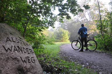
Figure 4
The Alsterwanderweg illustrates the Green Network concept
The concept of the Green Network reappeared in plan after plan during the 20th century, reaffirming the idea of interlinked open spaces aimed at enabling people to move around the city or from the city to the surrounding countryside using footpaths and cycle tracks undisturbed by road traffic and surrounded by greenery. On the Alsterwanderweg trail, cyclists and hikers travel by linked greenways from downtown to the reserves that largely dominate the northern end of Hamburg and now serve as a permanent home for fox, marten, polecat, badger, wild boar, and several deer species. Although not all of the green network has fully materialized, the Alsterwanderweg beautifully achieves Schumacher’s vision.
STOCKHOLM, SWEDEN
Stockholm, Sweden, with a city population of more than 800,000 in a region of 2 million, was Europe’s first Green Capital. In its City Plan 99, Stockholm put the brakes on urban sprawl with a strategy to “build the city inwards.” As the test case for this slogan, the city and its partners transformed an underutilized industrial area into Hammarby Sjostad. On completion, this redeveloped area will be home to 35,000 workers and residents centered on a tram route lined with high-density, mixed-use buildings. Its residential blocks use ponds and canals for stormwater control as well as the focal point for numerous open space features.

Figure 5
Water multi-tasks in Stockholm’s Hammarby Sjostad
Stockholm achieves high marks in all of the selection criteria and truly excels in its approach to open space. More than half of the central city, almost 30,000 acres, is green land (including waterways). Most prominently, Stockholm and two neighboring municipalities share National Stadspark, the world’s first national city park. Although adjacent to the city center, this 6,600-acre green space, which is also known as Ecopark, is home to hundreds of species including the largest stand of mature oaks in Northern Europe. National City Park constitutes one portion of one of Greater Stockholm’s green wedges — 10 large swaths of undeveloped land often linking dense urban areas with the rural countryside. The 26 municipalities in the Stockholm region recognize the eco-services provided by the green wedges, as well as the importance of access to nature as a critical component of urban livability. Although only 20 percent to 30 percent of these large open spaces are formally protected as nature reserves, the 10 green wedges are included in the land use plans of all 26 municipalities.
Stockholm’s 2010 regional plan calls for improving access to the green wedges by expanding the trail system and improving its links with public transportation. The plan also promotes the creation of additional nature reserves through continuation of a program known as “never far from nature.” Significantly, the 2010 plan articulates the multiple benefits resulting from building a polycentric metropolis in which green space planning is coordinated regionally with the creation of dense urban nodes. “By concentrating new urban development in a small number of areas, valuable cultural and natural environments can be preserved” (Stockholm County 2010, 23). In fact, the plan views this approach as one of the keys to achieving its vision of making Stockholm “Europe’s most attractive metropolitan region” (Stockholm County 2010, 13).
GREEN CAPITALS OF THE UNITED STATES?
The British Columbia Institute of Technology and Ecocity Builders, a nonprofit organization in Oakland, California, are jointly developing a tool allowing cities to evaluate their progress toward various levels of sustainability based on a comprehensive set of standards. This noncompetitive approach to measuring a city’s shade of green may not have the drama of the European Green Capital award process. But the Ecocity system will nevertheless provide similar benefits, including the opportunity for cities to gauge improvement, celebrate accomplishments, and build the public support needed to reach even more ambitious goals.
Author’s Note: For further information, visit the European Green Capitals website at
http://ec.europa.eu/environment/europeangreencapital/.
Rick Pruetz, FAICP, is a consultant specializing in preservation planning and transferable development rights. In 2012, Planners Press published Lasting Value: Open Space Planning and Preservation Successes, which explores the environmental accomplishments of 24 U.S. communities. Contact him at Rickpruetz@outlook.com and visit his website at www.smartpreservation.net.
References
Stockholm County. 2010. Regional Development Plan for the County of Stockholm, RUFS 2010. Stockholm: Stockholm County.
©Copyright 2014 American Planning Association All Rights Reserved