Ecomobility Snapshots
Heart of Florida Loop
Eight counties in central Florida are working to link their local trail networks to hundreds of miles of long-distance state and regional trails. As one example, they are currently partnering to create a circular 215-mile, multi-use trail dubbed the Heart of Florida Loop by closing gaps and connecting the following ten trails (100 Florida Trails 2023).
Marjorie Harris Carr Cross Florida Greenway
The Cross Florida Greenway protects an east-west swath of central Florida in Citrus, Levy, Marion, and Putnam counties. It began life as the Cross Florida Barge Canal, a vision dating from 1818 to build a navigable waterway from the Gulf of Mexico to the Atlantic Ocean. Less than one third of the 107-mile project was built between 1933 and 1971 when a lawsuit against the project was filed on environmental grounds by the Environmental Defense Fund and Florida Defenders of the Environment, the organization co-founded by Majorie Harris Carr. President Richard Nixon pulled the plug and the land assembled for the canal was turned over to the state of Florida for conservation/recreation purposes and renamed the Marjorie Harris Carr Cross Florida Greenway in 1998.
Today, the greenway protects 70,000 acres of interconnected forests, swamps, and rivers that offer over 300 miles of trails for mountain biking, horseback riding, hiking, and paddling. Roughly 31 miles of this total are paved including a segment south of Ocala in Marion County. West of Ocala, 30 miles of mountain biking trails can be reached from the Santos Trailhead and Campground. Cyclists share this area with bobcats, wild turkeys, black bears, and other wildlife, which can travel safely over Interstate 75 on the Cross Florida Greenway Land Bridge, said to be the first of its kind in the United States.

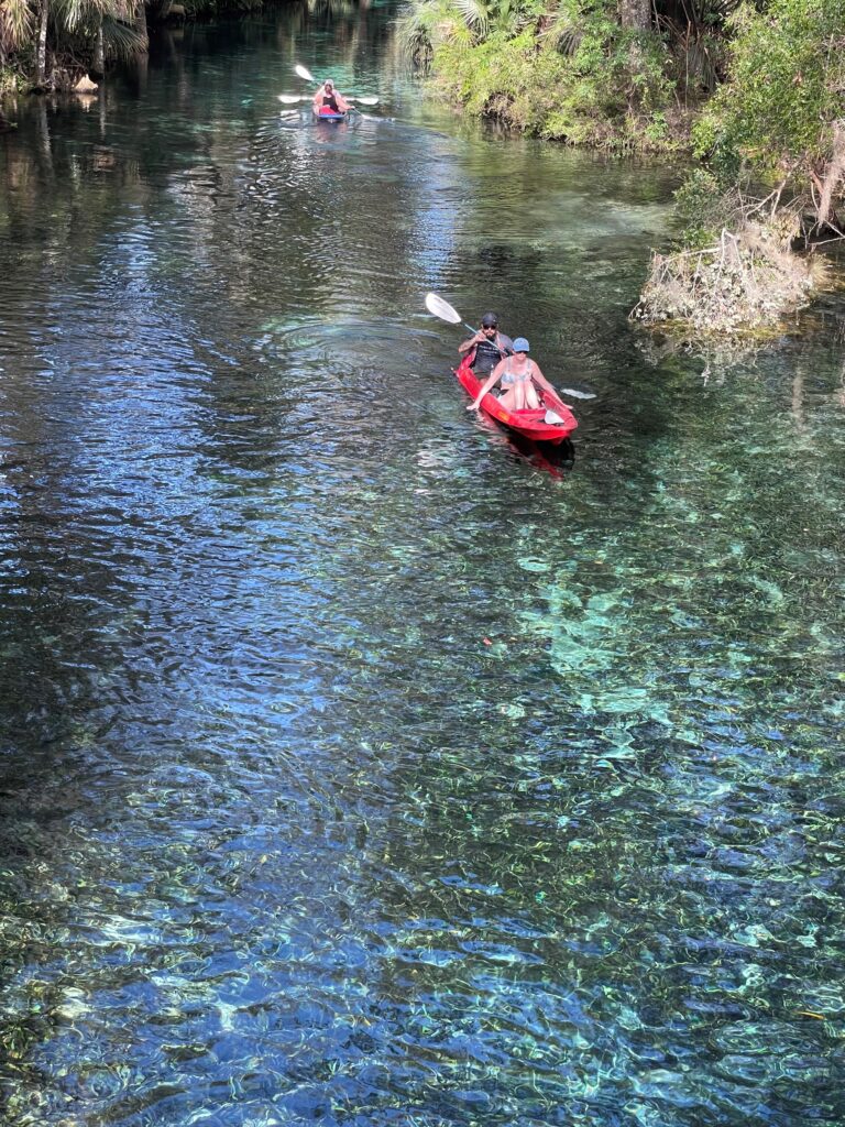
The Florida Horse Park lies to the east, helping to make these trails popular with equestrians as well as cyclists and hikers. In Silver Springs State Park, kayakers can paddle over springs and down a spring-fed river that supports abundant wildlife including allegators and, at times, manatees. Further north, adventurers seeking a longer journey can canoe all or portions of the 74-mile Ocklawaha River, which flows north to join the St. Johns River near Palatka. Preservation of the Ocklawaha ecosystem was a key reason why environmentalists fought to defeat the barge canal.
The Regional Trails Facility Plan for the Ocala Marion County Transportation Planning Organization aims to extend the paved sections of the Cross Florida Greenway, connect them with populated areas, and ultimately link them with regional trail networks including the Withlacoochee State Trail, the Nature Coast Trail, the Withlacoochee Bay Trail, the Coast-to-Coast Trail, the East Coast Greenway, and the Heart of Florida Loop. The Marion County Regional Trails Plan proposes to implement these goals beginning with six priority projects including a 21-mile multi-use trail to the northern county line which will link with a trail to Gainesville and the trail network of Alachua County (Ocala Marion TPO 2019).

Dunnellon Trail
The Dunnellon Trail provides a 2.5-mile link between the Cross Florida Greenway and the Withlacoochee State Trail by crossing the Withlacoochee River separating Marion County and Citrus County. The Dunnellon Trail also forms a small segment of the nascent Coast-to-Coast (C2C) Trail. On completion, C2C will stretch for 250 miles from St. Petersburg on Tampa Bay to Titusville, across from the Space Center at Cape Canaveral.
The Dunnellon Trail follows the Rainbow River, a popular stream for tubing and kayaking. Upstream, Rainbow Springs State Park features man-made waterfalls from its days as a privately-owned tourist attraction. Rainbow Springs, the fourth largest spring in Florida, offers swimming and snorkeling in clear, sapphire-blue water welling up at an average temperature of 72 degrees. The entire 5.7-mile length of the river is protected as an Aquatic Preserve due to its rich biodiversity.
Withlacoochee State Trail
Heading south through Citrus, Hernando, and Pasco counties, the 46-mile Withlacoochee State Trail parallels portions of the Withlacoochee River and explores six different ecosystems. Many of these natural landscapes are protected within Withlacoochee State Forest, Fort Cooper State Park, Croom Wildlife Management Area, and the Withlacoochee River itself. Inside the Withlacoochee State Forest, the ghost town of Croom dates back to 1884 when it was built on the banks of the Withlacoochee River as part of a railroad connecting Tampa with the Eastern Seaboard.
Using it as a key link to the regional active transportation network, the Hernando/Citrus Metropolitan Planning Organization Bikeways and Trails Master Plan proposes a total of 15 new trail or buffered bike lane connections to the Withlacoochee Trail and Heart of Florida Loop (Hernando/Citrus MPO 2018).
Similarly, Pasco County’s Comprehensive Plan calls for greenway/trail/blueway connectivity to adjacent counties. To put that pledge into action, Pasco County began the process of building a 37-mile multi-use trail in 2022 that will connect with the Coast-to Coast, Starkey, and Suncoast trails as well as the Withlacoochee State Trail.
Van Fleet State Trail
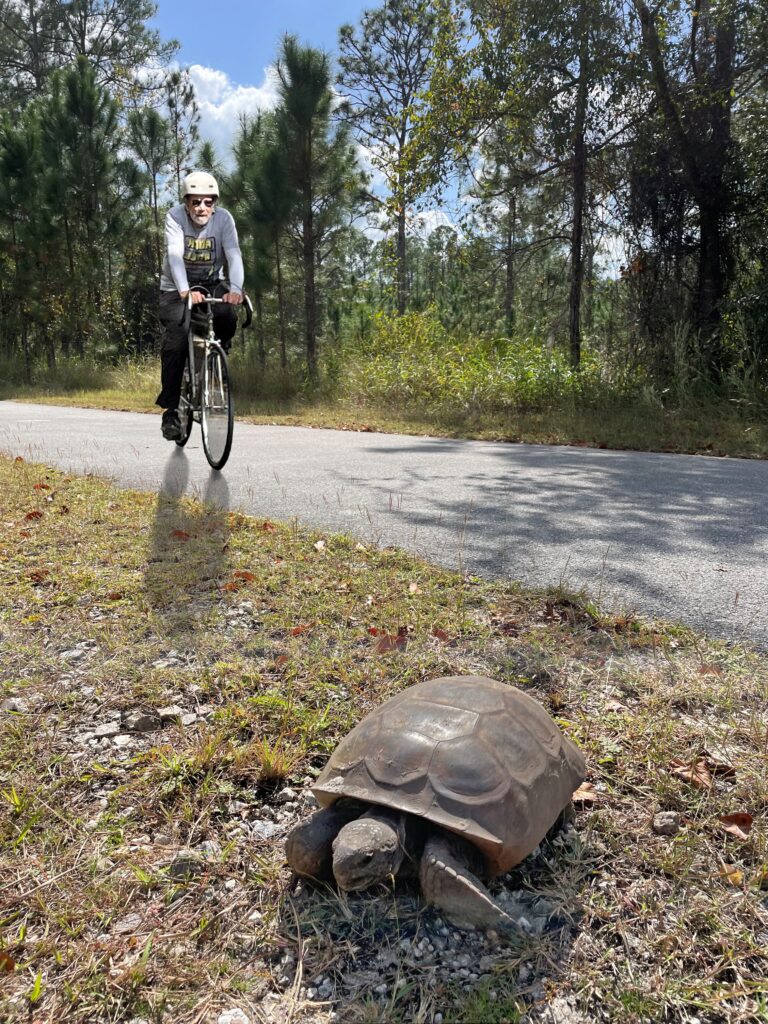
The Heart of Florida Loop uses a portion of the 29-mile Van Fleet State Trail which bisects the Green Swamp in Sumter, Lake, and Polk counties. This trail is a favorite of nature lovers who prefer a quiet trip past swamp and forest landscapes interspersed with cattle ranches and former citrus orchards. Cyclists here have a good chance of spotting wild turkeys, deer, wading birds, raptors, gopher tortoises, and alligators, particularly where the trail crosses three bridges north of Green Pond Road Trail Head. The southern section traverses the Green Swamp Wilderness Preserve, which protects the Florida Aquifer and the headwaters of the Withlacoochee, Ocklawaha, Peace, and Hillsborough rivers.

South Lake Trail
After closing the gap east of the Van Fleet State Trail, the 13-mile South Lake Trail creates another link in both the Heart of Florida Loop and Coast-to-Coast Trail. This segment includes some hill climbs offering scenic cycling with views of the region in general and Lake Minneola in particular as it overlooks the shoreline in Waterfront Park and Lake Hiawatha Preserve.
Located at the midpoint of the Florida Coast to Coast Trail, the City of Clermont has become a designated Florida Trail Town and is working to create Meet Us in the Middle Plaza to capitalize on Clermont’s location at the midpoint of the Coast-to-Coast Trail. The city’s plan includes completion of a Legacy Loop Trail linking the South Lake Trail with the lodging, shops, and restaurants of downtown Clermont. Due largely to its plans for building off the regional trail system, Clermont was named Florida’s Bicycle-Friendly Community of the Year.
West Orange Trail
The 23-mile West Orange Trail extends east from the Orange/Lake County line to the City of Apopka, passing though communities once surrounded by miles of orange groves. The trail uses a median to pass through downtown Winter Garden, a city that follows the trail town playbook, offering multiple choices for food, drink, bike shops, and a railroad museum aimed at motivating cyclists to pause and contribute to the local economy. The trail is credited with helping to revitalize this previously blighted downtown. A few miles before the end of this trail, the route of both the Coast-to-Coast Trail and the Heart of Florida Loop leave the West Orange Trail to join the Seminole Wekiva Trail.
Metropolitan Orlando, a regional transportation partnership, uses a scoring system for prioritizing bikeway projects that gives the heaviest weighting to long trails that link with other trails of regional significance. The planning process consequently prioritizes a Coast-to-Coast Connector that will close two gaps in the Orlando region portion of the Coast-to-Coast Trail. The Metro Orlando 2040 Long Range Transportation Plan emphasizes that completion of this Connector will link many existing trails in the region including the West Orange, Clarcona-Ocoee, Pine Hill, Seminole Wekiva, and Rinehart trails.
Seminole Wekiva Trail
The 27-mile Seminole Wekiva Trail takes cyclists through the suburbs of Orlando. Heading north, it comes within a few miles of a complex of parks, preserves, and wildlife management areas that give visitors a taste of natural Florida while protecting the significant ecology of the Wekiva River, which the US Congress designated as a Wild and Scenic River in 2000.
Cross Seminole Trail
The Cross Seminole Trail is now complete for the entire 28-mile length of Seminole County and links with the Cady Way Trail, the Sanford Riverwalk, and the Spring-to-Spring Trail as well as serving a segment of the Heart of Florida Loop by connecting to the Seminole Wekiva Trail. One segment of this trail uses the right of way created by the Sanford and Indian River Railroad. From the trail, cyclists can access the 1,500-acre Spring Hammock Preserve, which encompasses Big Tree Park, Soldier’s Creek Park, and a boardwalk offering a glimpse of natural Florida, including second-growth cypress forest. At the north end of the Cross Seminole Trail, the Heart of Florida Loop uses Highway 17 bridge to cross the St. Johns River from Lake Monroe Wayside Park in Seminole to link with the Spring-to-Spring Trail in Volusia County.
Spring-to-Spring Trail
The 27-mile Spring-to-Spring Trail forms parts of the Coast-to-Coast Trail and the St Johns River-to-Sea Loop as well as the Heart of Florida Loop. Toward the southern end of this trail, Gemini Springs Park is a 212-acre county park with bikeways, a nature trail, a campground, and two springs that gush over six million gallons of water each day. Completed portions of the trail pass Blue Springs State Park, Lake Beresford Park, Lake Woodruff National Wildlife Refuge, Chuck Lennon Park, and De Leon Springs State Park. Volusia County plans to extend the Spring-to-Spring Trail a few miles north of DeLeon Springs State Park to Highway 40, where the Black Bear Trail is proposed to link with Marion County 50 miles to the west.
In the late 1800s, the springs were renamed Ponce de Leon Springs, possibly an attempt to lure wealthy tourists looking for the Fountain of Youth. The land that is now the 625-acre DeLeon Springs State Park was once home to a small hotel and a roadside attraction featuring a tram tour, a jungle cruise, tropical gardens, and a water-skiing elephant. Today, DeLeon Springs State Park includes a segment of the Great Florida Birding and Wildlife Trail, boat tours, swimming, snorkeling, and trails where hikers can encounter Florida black bears and wild hogs as well as deer, turkeys, and bobcats.
Volusia County Trails Plan pursues the goal of linking parks, schools, and commercial centers using Showcase Multi-Use Trails built by the county that connect to trails built by individual cities. The Spring-to-Spring Trail is the county’s first Showcase Trail. Volusia and Brevard counties are also developing the East Florida Regional Rail Trail which will stretch for over 50 miles from Deltona to Edgewater in Volusia County and through Brevard County to Titusville.

Black Bear Trail
To complete the north leg of the Heart of Florida Loop, a trail has been proposed to parallel State Road 40 linking the end of the extension of the Spring-to-Spring Trail near Highway 17 in Volusia County with the future extension of the Cross Florida Greenway in Marion County. Called the Black Bear Trail, this bikeway will pass through Lake George State Forest, the Ocala Wildlife Management Area, and the Juniper Springs Recreation Area. This trail is listed as funded on the Marion Ocala TPO Regional Trails and Facilities Plan however the eastern portion in Volusia County was still unfunded as of 2023.
References
100 Florida Trails. Heart of Florida Loop. Accessed at https://www.100floridatrails.com/trails/heart-of-florida-loop.htm.
Hernando/Citrus MPO (Metropolitan Planning Organization). 2018. Bikeways and Trails Master Plan. Accessed at https://www.hernandocounty.us/home/showpublisheddocument/5281/636831504232400000.
Marion Ocala TPO (Transportation Planning Organization). 2019. Regional Trails and Facilities Plan. Accessed at https://ocalamariontpo.org/wp-content/uploads/2019/12/Regional-Trails-Facilities-Plan-FINAL-11-2019.pdf.
